ExploreChile 忘れられない 冒険を


← すべての地域
マガジャネス
世界の果て、そして南極の始まりです。マガジャネス州にはトーレス・デル・パイネ国立公園が含まれており、そこにある花崗岩の塔と氷河は地球上で最も写真撮影される風景の一つです。プンタ・アレナスはマゼラン海峡を見下ろし、南極クルーズの出発点として機能しています。
音声版あり
トーレス・デル・パイネ, パタゴニアの大聖堂
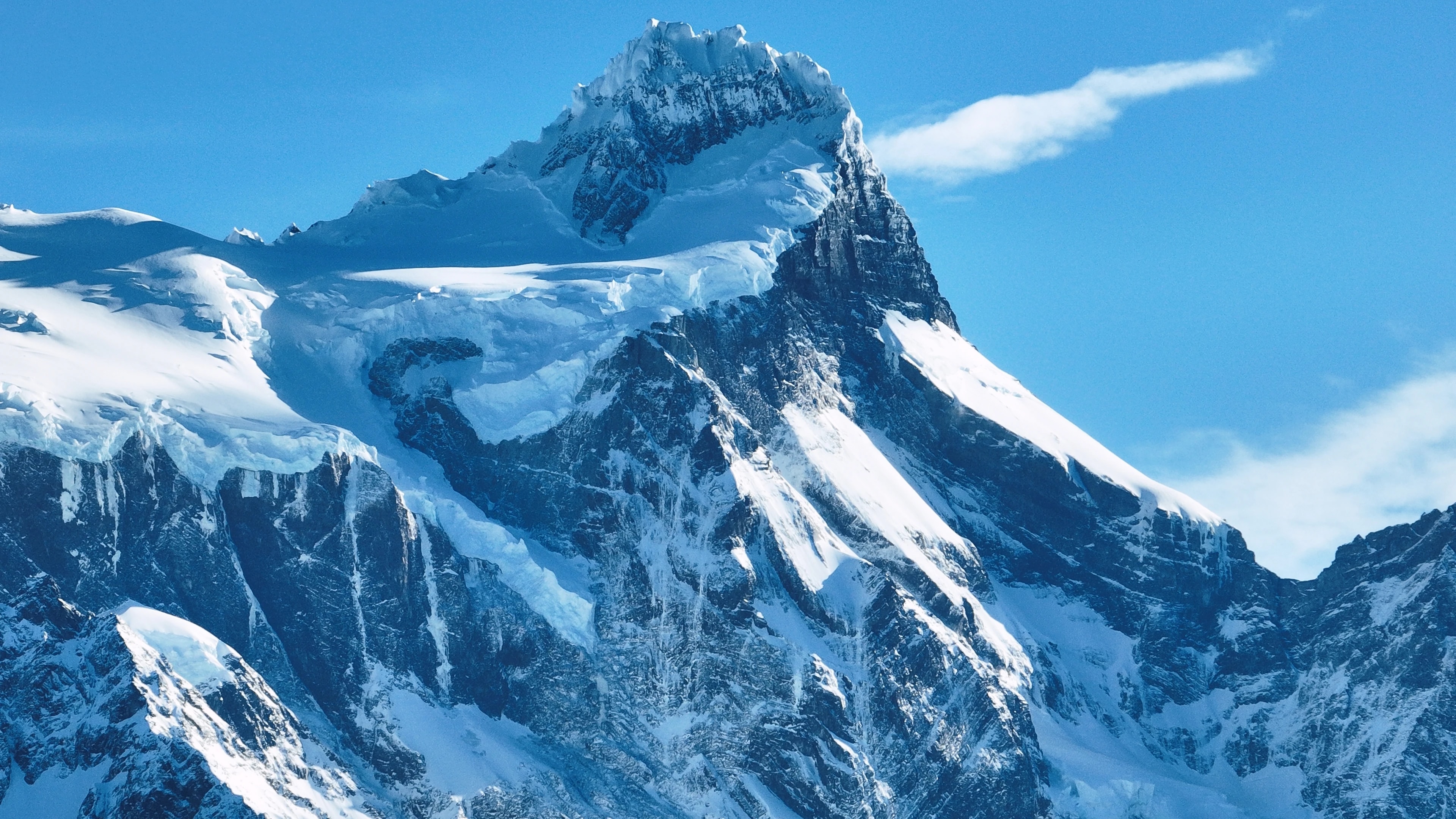
多くの旅行者にとって、トーレス・デル・パイネ国立公園はチリを訪れる理由です。3つの花崗岩の塔(日の出にピンクに輝くそびえ立つ岩の柱)が公園の象徴的なイメージですが、それらは始まりに過ぎません。公園は、電気のように青い湖、懸垂氷河、グアナコが歩き回る草原、そして秋に金色に変わるレンガブナの森に囲まれた山塊全体を含んでいます。
塔、フレンチ渓谷、グレイ氷河を訪れる4〜5日間のサーキットであるWトレックは、世界で最も有名なマルチデイハイクの一つで、完全なOサーキット(7〜9日間)は、ほとんどの訪問者が見ることのない原野を通って山塊全体を取り囲みます。
南パタゴニア氷原の一部であるグレイ氷河は、絶えず変化する青い彫刻庭園の中でカヤッカーやカタマラン乗船者を通り過ぎて流れる氷山をラゴ・グレイに剥落させます。公園にはピューマ、アンデスコンドル、キツネ、そして大陸で最も健全なグアナコの個体群の一つが生息しています。
プンタ・アレナス, 南極への玄関口
州都プンタ・アレナスは、世界で同じ規模の都市として最も南に位置しており、南米本土とティエラ・デル・フエゴを隔てるマゼラン海峡を見下ろす、風に打たれた13万人の港湾都市です。1848年に流刑地と石炭補給基地として設立され、19世紀後半の羊牧場のブームの間に裕福になり、プラサ・デ・アルマスに沿った豪華な邸宅、特にパラシオ・サラ・ブラウンは、パタゴニアのウール男爵たちが築いた財産を証明しています。
今日、プンタ・アレナスは南極探検クルーズの出発点で、船はドレーク海峡を通って白い大陸へ南下します。
ヒノキの並木道と精巧な霊廟があるこの街のセメンテリオ・ムニシパル(市営墓地)は、アメリカ大陸で最も美しい墓地の一つと考えられています。近くにあるマグダレナ島のペンギンコロニー(60,000ペアの繁殖マゼランペンギン)は、短いフェリー乗船で到着できます。
ティエラ・デル・フエゴ, 地球の果て
マゼラン海峡を越えて、ティエラ・デル・フエゴのチリ側半分は、草原、泥炭湿原、そして地球上で最も南にある森林が広がる風の吹きさらしの地域です。島の主要な集落であるポルベニールは、ブリキ屋根の家々と金鉱のラッシュの歴史を持つ静かな町で、チリとクロアチアの移民文化がフロンティアの雰囲気の中で融合しています。
島の内部には、羊が人間を桁違いに上回る広大なエスタンシアがあり、バイーア・イヌティルのキングペンギンコロニー(南米本土で唯一の重要なキングペンギンコロニー)は、地域で最も並外れた野生動物体験の一つです。
島の南端にある、野生動物保護協会によって設立されたパルケ・カルキンカは、ティエラ・デル・フエゴの最後の無傷の森林(絶滅危惧種のクルペオギツネ、パタゴニアキツツキ、そして捉えにくいウエムル鹿を守る古代のレンガとコイゲの木々)を保護しています。
氷河、フィヨルド、そして氷原
マガジャネス州には、13,000平方キロメートルで南極とグリーンランドに次いで世界で3番目に大きな淡水保有地である南パタゴニア氷原が含まれています。その氷河はアンデス山脈を通ってフィヨルドや湖に流れ込み、地球上で最も壮観な水景の一部を形成しています。グレイ、ティンダル、バルマセダ氷河はトーレス・デル・パイネとプエルト・ナタレスからアクセス可能ですが、より遠隔のピオXI氷河(南極以外の南半球で最大)は、フィヨルドを通る複数日のボート探検でのみ到達できます。
ウルティマ・エスペランサ(最後の希望の入り江)の水路には、ザトウクジラ、ヒョウアザラシ、コマーソンイルカが生息しており、プエルト・ナタレスからバルマセダとセラーノ氷河へのボート旅行は、驚くべき壮大さの景色を通過します。
チリ最大の保護区であるベルナルド・オイギンス国立公園は、この氷原とその周辺の原野の大部分を含んでおり、あまりに広大でアクセス困難であるため、その大部分は未探検のままです。
パタゴニアの文化, 風、ウール、そしてアサード
マガジャネスでの生活は要素によって形作られます。木々を水平に曲げる容赦ないパタゴニアの風、長い冬の暗闇、そして太陽がほとんど沈まない短いが光り輝く夏です。この厳しい環境が、自己依存、温かさ、そしてブラックユーモアの独特な文化を鍛え上げました。多くがまだ実働中の羊牧場として運営されているエスタンシアは、この世界への本物の窓を提供します。訪問者は羊の毛刈り、馬上での追い込み、そして伝説的なパタゴニアのアサード・アル・パロの準備に参加できます。そこでは、羊全体が金属の十字架に広げられ、開放火で何時間もかけてじっくり焼かれます。
トーレス・デル・パイネへの魅力的な玄関の町プエルト・ナタレスでは、レストランがその朝フィヨルドから引き上げられたセントージャ(タラバガニ)を提供し、カラファテベリーのデザートが添えられます。カラファテとは、地元の伝説によれば、その実を食べる人はパタゴニアに戻ることを約束される在来の低木です。
訪れる人でこれに異議を唱える人はほとんどいないでしょう。
見どころ
都市
都市
Puerto Natales
Western gateway to Parque Nacional Torres del Paine and the launching point for Patagonian fjord cruises, Puerto Natales sits on Última Esperanza Sound 250 km north of Punta Arenas. The town began as a sheep-ranching outpost in the 1880s; its old Frigorífico Bories cold-store complex, now a museum, is the largest surviving industrial monument in Chilean Patagonia. Today its waterfront, lined with hostels and outfitters, is the staging area for the 'W' and 'O' treks through Torres del Paine.
都市
Punta Arenas
Capital of Magallanes and largest city in Chilean Patagonia, founded in 1848 as a penal colony on the Strait of Magellan. Punta Arenas grew rich on the late-nineteenth-century wool boom, leaving behind the European-style mansions of the Sara Braun and Menéndez families around Plaza Muñoz Gamero. Today it is the embarkation point for Antarctic expeditions and the cruise route to Cape Horn, and its Cementerio Municipal is considered one of the most striking historic cemeteries in South America.
都市
Porvenir
Capital of the Chilean side of Tierra del Fuego, founded during the 1880s gold rush as miners poured into the island. Porvenir sits across the Strait of Magellan from Punta Arenas, reached by a two-hour ferry from Bahía Chilota or a longer crossing from Punta Delgada. The town's small Croatian community, descendants of immigrant miners, is commemorated in the Museo Fernando Cordero Rusque, and Bahía Inútil to the south hosts one of the largest king penguin colonies outside Antarctica.
都市
Puerto Williams
Southernmost permanently inhabited settlement in the world, on Isla Navarino south of the Beagle Channel. Founded in 1953 as a Chilean naval base to assert sovereignty against Argentina's Ushuaia across the channel, Puerto Williams remains the seat of Cabo de Hornos Province. The town is the access point for the Dientes de Navarino trek and the last waypoint for yachts bound for Cape Horn or the Antarctic Peninsula.
自然保護区
自然保護区
Parque Nacional Bernardo O'Higgins
Chile's largest national park at 3.5 million hectares, covering most of the Southern Patagonian Ice Field and the maze of fjords running north into Aysén. The park contains 49 glaciers — including Pío XI, the largest non-polar glacier in the southern hemisphere — and is accessed only by boat from Puerto Natales or Puerto Edén.
自然保護区
Parque Nacional Kawésqar
Created in 2019 by upgrading the former Alacalufes National Reserve, Kawésqar covers 2.8 million hectares of fjords, channels and ice fields west of Puerto Natales. The park is named for the Kawésqar, canoe-faring nomads who navigated these waters for at least 6,000 years and whose last fluent speakers still live in Puerto Edén.
自然保護区
Cueva del Milodón
A 200-metre limestone cave 24 km north of Puerto Natales where, in 1895, a German settler discovered a piece of mylodon hide — the partly mummified skin of a giant ground sloth that lived here at the end of the Ice Age. The find triggered international fossil expeditions and is referenced in Bruce Chatwin's 'In Patagonia'. A life-size mylodon statue stands at the cave entrance.
自然保護区
Glaciar Serrano
Tidewater glacier in the Southern Patagonian Ice Field, reached by a half-day boat journey up Última Esperanza Sound and the Río Serrano from Puerto Natales. The trip threads past calving icebergs and the towering Cerro Balmaceda before arriving at a small landing on the glacier's face.
自然保護区
Glaciar Grey
Twelve-kilometre-wide glacier flowing east off the Southern Patagonian Ice Field into Lago Grey, on the western edge of Torres del Paine. Icebergs calved from its face drift across the lake to a black-sand beach at its eastern end. Catamaran tours from Hostería Lago Grey navigate among the floes, and the glacier marks the second day of the 'W' trek.
自然保護区
Parque Nacional Torres del Paine
Chile's most celebrated national park (242,000 hectares), centred on the three granite spires of the Paine Massif rising 2,800 m above the Patagonian steppe. The 'W' and 'O' treks circling the massif have become the most famous multi-day hikes in South America. Inside the park: Grey Glacier flowing off the Southern Patagonian Ice Field, the milky-blue Lago Pehoé, and herds of guanacos that recovered after pumas drove them back from the brink.
自然保護区
Parque Nacional Pali Aike
Volcanic steppe park 200 km north-east of Punta Arenas, on the Chilean–Argentine border. Pali Aike means 'devil's country' in the Tehuelche language: the moonscape of cinder cones, lava flows and pampa is dotted with caves where some of the oldest human remains in the Americas (10,000+ BP) have been excavated.
自然保護区
Reserva Nacional Magallanes
A 20,000-hectare reserve right at the back door of Punta Arenas, protecting Lenga forest and the watersheds of the Río de las Minas. Trails climb to the Cerro Mirador viewpoint and the small Andino Club ski centre — the southernmost in continental South America.
自然保護区
Isla Magdalena
A treeless 85-hectare island in the Strait of Magellan, two hours by boat from Punta Arenas, hosting a colony of about 120,000 Magellanic penguins between October and March. A clearly-marked boardwalk threads through the burrows; the rest of the island is closed to protect the nesting birds.
自然保護区
Parque Pingüino Rey
Private 4,000-hectare reserve on Bahía Inútil in north-central Chilean Tierra del Fuego, protecting the only king-penguin colony on the South American continent — about 60 birds that returned to the bay in 2010 after a century of being hunted nearly to extinction. A short boardwalk skirts the colony at a respectful distance; visits are by guided tour, and the king penguins are present year-round with chicks visible from late summer.
自然保護区
Parque Karukinka
297,000-hectare conservation park covering the southern half of Chilean Tierra del Fuego, managed by the Wildlife Conservation Society after Goldman Sachs donated the land in 2004. Karukinka, which means 'our land' in the Selk'nam language, protects sub-Antarctic forests, peatlands and the largest guanaco population in southern Chile.
自然保護区
Isla Santa Inés
Large remote island west of Tierra del Fuego, draped in southern Patagonian rainforest and capped by the De Agostini ice field. Inhabited only by occasional crab fishermen, the island is accessible mainly by expedition cruise and remains one of the least-visited corners of Chilean Patagonia.
自然保護区
Parque Nacional Alberto de Agostini
Vast 1.46-million-hectare park covering the Cordillera Darwin range and a maze of southern Tierra del Fuego fjords, named for the Italian Salesian priest who first explored and mapped the area in the early twentieth century. Accessible only by sea, the park's tidewater glaciers — including the Pía and Garibaldi — are highlights of cruise itineraries from Punta Arenas to Ushuaia.
自然保護区
Parque Nacional Cabo de Hornos
Southernmost national park in the world, covering Isla Hornos and the surrounding archipelago at the convergence of the Pacific and Atlantic oceans. Cape Horn, the rocky headland that marks the navigational southern tip of the Americas, has been a UNESCO Biosphere Reserve since 2005 for its sub-Antarctic mossy forests, peat bogs, and the only known species-rich miniature flora in the world.