ExploreChilevivendo avventure indimenticabili


← Tutte le Regioni
Magallanes y de la Antártica Chilena
La fine del mondo, e l'inizio dell'Antartide. La Regione di Magallanes comprende il Parque Nacional Torres del Paine, le cui torri di granito e ghiacciai figurano tra i paesaggi più fotografati del pianeta. Punta Arenas si affaccia sullo Stretto di Magellano e funge da punto di partenza per le crociere antartiche.
Versione audio disponibile
Torres del Paine, Cattedrale della Patagonia
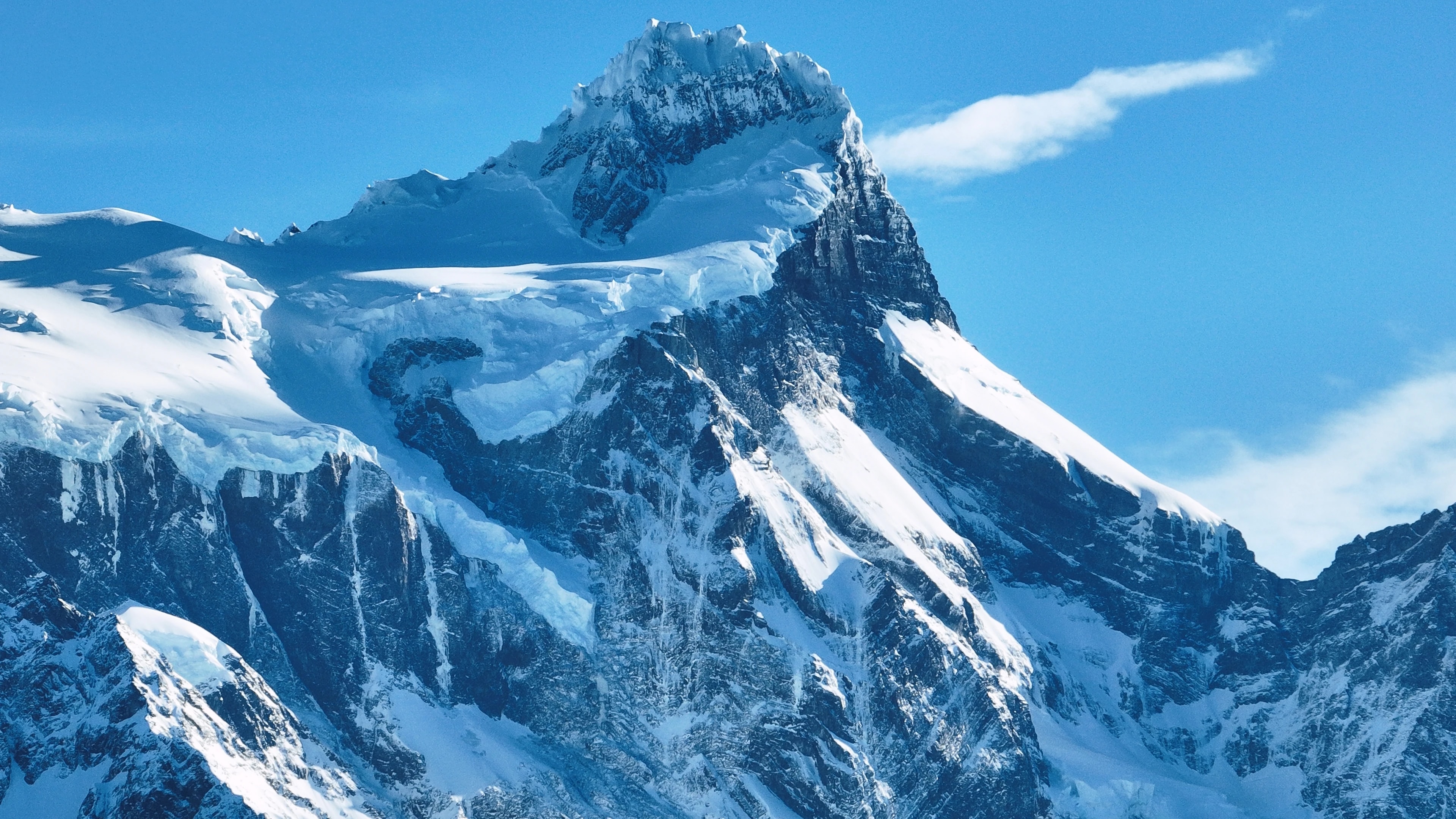
Il Parque Nacional Torres del Paine è, per molti viaggiatori, la ragione per venire in Cile. Le tre torri di granito, pilastri di roccia che si tingono di rosa all'alba, sono l'immagine iconica del parco, ma sono solo l'inizio. Il parco comprende un intero massiccio montuoso circondato da laghi blu elettrico, ghiacciai sospesi, praterie percorse da guanachi e foreste di lenga che si tingono d'oro in autunno.
Il Trekking W, un circuito di 4-5 giorni che visita le torri, la Valle del Francés e il Glaciar Grey, è uno dei trekking di più giorni più famosi al mondo, mentre il circuito O completo (7-9 giorni) circonda l'intero massiccio attraverso una natura selvaggia che pochi visitatori conoscono.
Il Glaciar Grey, un braccio del Campo de Hielo Sur, stacca iceberg nel Lago Grey che derivano davanti a kayakisti e passeggeri di catamarano in un giardino di sculture azzurre in costante cambiamento. Il parco ospita puma, condor andini, volpi e una delle popolazioni di guanachi più sane del continente.
Punta Arenas, Porta d'Accesso all'Antartide
Punta Arenas, il capoluogo regionale, è la città più australe delle sue dimensioni al mondo, un porto battuto dal vento di 130.000 abitanti che si affaccia sullo Stretto di Magellano, che separa il continente sudamericano dalla Terra del Fuoco. Fondata come colonia penale e stazione di rifornimento carbonifero nel 1848, crebbe con la bonanza ovina di fine XIX secolo, e le grandi ville lungo la Plaza de Armas, in particolare il Palacio Sara Braun, testimoniano le fortune accumulate con la lana patagonica.
Oggi, Punta Arenas è il punto di partenza delle crociere di spedizione in Antartide, con navi dirette a sud attraverso il Passaggio di Drake verso il continente bianco.
Il cimitero municipale della città, con i suoi viali di cipressi e gli elaborati mausolei, è considerato uno dei cimiteri più belli delle Americhe. Nelle vicinanze, la colonia di pinguini dell'Isla Magdalena, 60.000 coppie riproduttive di pinguino di Magellano, si trova a un breve viaggio in traghetto.
Terra del Fuoco, La Fine della Terra
Dall'altra parte dello Stretto di Magellano, la metà cilena della Terra del Fuoco è un'estensione battuta dal vento di pascoli, torbiere e le foreste più australi del pianeta. Porvenir, il principale insediamento dell'isola, è un paese tranquillo di case con tetti di zinco e una storia di corsa all'oro, dove le culture di immigrati cileni e croati si mescolano in un'atmosfera di frontiera.
L'interno dell'isola ospita vaste estancias dove le pecore superano gli umani in proporzioni schiaccianti, e la colonia di pinguini reali a Bahía Inútil, l'unica colonia significativa di pinguini reali nel Sudamerica continentale, è una delle esperienze faunistiche più straordinarie della regione.
All'estremo sud dell'isola, il Parque Karukinka, istituito dalla Wildlife Conservation Society, protegge le ultime foreste intatte della Terra del Fuoco, lengas e coigüe ancestrali che danno rifugio alla minacciata volpe culpeo, ai picchi patagonici e all'elusivo huemul.
Ghiacciai, Fiordi e i Campi di Ghiaccio
La Regione di Magallanes contiene il Campo de Hielo Sur, con 13.000 chilometri quadrati, la terza più grande riserva di acqua dolce al mondo dopo l'Antartide e la Groenlandia. I suoi ghiacciai scendono lungo le Ande verso fiordi e laghi che si annoverano tra i paesaggi acquatici più spettacolari della Terra. I ghiacciai Grey, Tyndall e Balmaceda sono accessibili da Torres del Paine e Puerto Natales, mentre il più remoto Glaciar Pío XI, il più grande dell'emisfero australe al di fuori dell'Antartide, si raggiunge solo mediante spedizioni in barca di più giorni attraverso i fiordi.
I canali di Última Esperanza ospitano megattere, foche leopardo e delfini di Commerson, e il viaggio in barca da Puerto Natales ai ghiacciai Balmaceda e Serrano si svolge attraverso paesaggi di grandiosità mozzafiato.
Il Parque Nacional Bernardo O'Higgins, l'area protetta più grande del Cile, comprende gran parte di questo campo di ghiaccio e la natura circostante, una regione così vasta e inaccessibile che grandi porzioni rimangono inesplorate.
Cultura Patagonica, Vento, Lana e Asado
La vita a Magallanes è plasmata dagli elementi: il vento patagonico implacabile che piega gli alberi in orizzontale, la lunga oscurità invernale e le brevi ma luminose estati quando il sole quasi non tramonta. Questo ambiente aspro ha forgiato una cultura distintiva di autosufficienza, calore e umorismo nero. Le estancias, molte ancora in funzione come ranch ovini, offrono una finestra autentica su questo mondo: i visitatori possono partecipare alla tosatura, alla conduzione del gregge a cavallo e alla preparazione del leggendario asado al palo patagonico, dove un intero agnello viene aperto su una croce di metallo e arrostito lentamente al fuoco vivo per ore.
A Puerto Natales, l'incantevole paese porta di Torres del Paine, i ristoranti servono centolla pescata nei fiordi quella mattina, accompagnata da dessert di calafate, una bacca nativa il cui arbusto, secondo la leggenda locale, garantisce che chi la assaggia tornerà in Patagonia.
Pochi che la visitano sarebbero in disaccordo.
Punti di Interesse
Città
Città
Puerto Natales
Western gateway to Parque Nacional Torres del Paine and the launching point for Patagonian fjord cruises, Puerto Natales sits on Última Esperanza Sound 250 km north of Punta Arenas. The town began as a sheep-ranching outpost in the 1880s; its old Frigorífico Bories cold-store complex, now a museum, is the largest surviving industrial monument in Chilean Patagonia. Today its waterfront, lined with hostels and outfitters, is the staging area for the 'W' and 'O' treks through Torres del Paine.
Città
Punta Arenas
Capital of Magallanes and largest city in Chilean Patagonia, founded in 1848 as a penal colony on the Strait of Magellan. Punta Arenas grew rich on the late-nineteenth-century wool boom, leaving behind the European-style mansions of the Sara Braun and Menéndez families around Plaza Muñoz Gamero. Today it is the embarkation point for Antarctic expeditions and the cruise route to Cape Horn, and its Cementerio Municipal is considered one of the most striking historic cemeteries in South America.
Città
Porvenir
Capital of the Chilean side of Tierra del Fuego, founded during the 1880s gold rush as miners poured into the island. Porvenir sits across the Strait of Magellan from Punta Arenas, reached by a two-hour ferry from Bahía Chilota or a longer crossing from Punta Delgada. The town's small Croatian community, descendants of immigrant miners, is commemorated in the Museo Fernando Cordero Rusque, and Bahía Inútil to the south hosts one of the largest king penguin colonies outside Antarctica.
Città
Puerto Williams
Southernmost permanently inhabited settlement in the world, on Isla Navarino south of the Beagle Channel. Founded in 1953 as a Chilean naval base to assert sovereignty against Argentina's Ushuaia across the channel, Puerto Williams remains the seat of Cabo de Hornos Province. The town is the access point for the Dientes de Navarino trek and the last waypoint for yachts bound for Cape Horn or the Antarctic Peninsula.
Riserve Naturali
Riserve Naturali
Parque Nacional Bernardo O'Higgins
Chile's largest national park at 3.5 million hectares, covering most of the Southern Patagonian Ice Field and the maze of fjords running north into Aysén. The park contains 49 glaciers — including Pío XI, the largest non-polar glacier in the southern hemisphere — and is accessed only by boat from Puerto Natales or Puerto Edén.
Riserve Naturali
Parque Nacional Kawésqar
Created in 2019 by upgrading the former Alacalufes National Reserve, Kawésqar covers 2.8 million hectares of fjords, channels and ice fields west of Puerto Natales. The park is named for the Kawésqar, canoe-faring nomads who navigated these waters for at least 6,000 years and whose last fluent speakers still live in Puerto Edén.
Riserve Naturali
Cueva del Milodón
A 200-metre limestone cave 24 km north of Puerto Natales where, in 1895, a German settler discovered a piece of mylodon hide — the partly mummified skin of a giant ground sloth that lived here at the end of the Ice Age. The find triggered international fossil expeditions and is referenced in Bruce Chatwin's 'In Patagonia'. A life-size mylodon statue stands at the cave entrance.
Riserve Naturali
Glaciar Serrano
Tidewater glacier in the Southern Patagonian Ice Field, reached by a half-day boat journey up Última Esperanza Sound and the Río Serrano from Puerto Natales. The trip threads past calving icebergs and the towering Cerro Balmaceda before arriving at a small landing on the glacier's face.
Riserve Naturali
Glaciar Grey
Twelve-kilometre-wide glacier flowing east off the Southern Patagonian Ice Field into Lago Grey, on the western edge of Torres del Paine. Icebergs calved from its face drift across the lake to a black-sand beach at its eastern end. Catamaran tours from Hostería Lago Grey navigate among the floes, and the glacier marks the second day of the 'W' trek.
Riserve Naturali
Parque Nacional Torres del Paine
Chile's most celebrated national park (242,000 hectares), centred on the three granite spires of the Paine Massif rising 2,800 m above the Patagonian steppe. The 'W' and 'O' treks circling the massif have become the most famous multi-day hikes in South America. Inside the park: Grey Glacier flowing off the Southern Patagonian Ice Field, the milky-blue Lago Pehoé, and herds of guanacos that recovered after pumas drove them back from the brink.
Riserve Naturali
Parque Nacional Pali Aike
Volcanic steppe park 200 km north-east of Punta Arenas, on the Chilean–Argentine border. Pali Aike means 'devil's country' in the Tehuelche language: the moonscape of cinder cones, lava flows and pampa is dotted with caves where some of the oldest human remains in the Americas (10,000+ BP) have been excavated.
Riserve Naturali
Reserva Nacional Magallanes
A 20,000-hectare reserve right at the back door of Punta Arenas, protecting Lenga forest and the watersheds of the Río de las Minas. Trails climb to the Cerro Mirador viewpoint and the small Andino Club ski centre — the southernmost in continental South America.
Riserve Naturali
Isla Magdalena
A treeless 85-hectare island in the Strait of Magellan, two hours by boat from Punta Arenas, hosting a colony of about 120,000 Magellanic penguins between October and March. A clearly-marked boardwalk threads through the burrows; the rest of the island is closed to protect the nesting birds.
Riserve Naturali
Parque Pingüino Rey
Private 4,000-hectare reserve on Bahía Inútil in north-central Chilean Tierra del Fuego, protecting the only king-penguin colony on the South American continent — about 60 birds that returned to the bay in 2010 after a century of being hunted nearly to extinction. A short boardwalk skirts the colony at a respectful distance; visits are by guided tour, and the king penguins are present year-round with chicks visible from late summer.
Riserve Naturali
Parque Karukinka
297,000-hectare conservation park covering the southern half of Chilean Tierra del Fuego, managed by the Wildlife Conservation Society after Goldman Sachs donated the land in 2004. Karukinka, which means 'our land' in the Selk'nam language, protects sub-Antarctic forests, peatlands and the largest guanaco population in southern Chile.
Riserve Naturali
Isla Santa Inés
Large remote island west of Tierra del Fuego, draped in southern Patagonian rainforest and capped by the De Agostini ice field. Inhabited only by occasional crab fishermen, the island is accessible mainly by expedition cruise and remains one of the least-visited corners of Chilean Patagonia.
Riserve Naturali
Parque Nacional Alberto de Agostini
Vast 1.46-million-hectare park covering the Cordillera Darwin range and a maze of southern Tierra del Fuego fjords, named for the Italian Salesian priest who first explored and mapped the area in the early twentieth century. Accessible only by sea, the park's tidewater glaciers — including the Pía and Garibaldi — are highlights of cruise itineraries from Punta Arenas to Ushuaia.
Riserve Naturali
Parque Nacional Cabo de Hornos
Southernmost national park in the world, covering Isla Hornos and the surrounding archipelago at the convergence of the Pacific and Atlantic oceans. Cape Horn, the rocky headland that marks the navigational southern tip of the Americas, has been a UNESCO Biosphere Reserve since 2005 for its sub-Antarctic mossy forests, peat bogs, and the only known species-rich miniature flora in the world.